Why is knowing the location of things important?
It tells you whether you have just landed in Switzerland or Hong Kong. It lets your Roomba know how many chair legs to hit while cleaning your floor. It makes self-driving vehicles and marathon running robots possible. It divides countries, separates you from that one annoying neighbour, and determines if your car will get wheel-clamped if you dally for too long.
What does it take to get the location of something right though?
It certainly varies from case to case. 3 to 10 meters of accuracy is good enough to find your way to a café tucked away in the corner of a neighbourhood, but what about laying water and gas mains to its kitchen? In our niche of civil works – subsurface utility engineering – the difference between knowing exactly where things are beneath our feet and otherwise is getting paid for successfully completing a project or appearing in the news for causing a gas leak.
Does this mean millimetre to no error in the topographic survey of locations the right and only way for our type of work? The pursuit of ground truth is desirable, but there is a point where the costs outweigh the absolute. We pitted four technologies and methods commonly used in industry today against each other to determine where to draw the line in the sand.
The proving grounds: a junction in a non-mature estate in Singapore, where there are still many utilities in need of building.
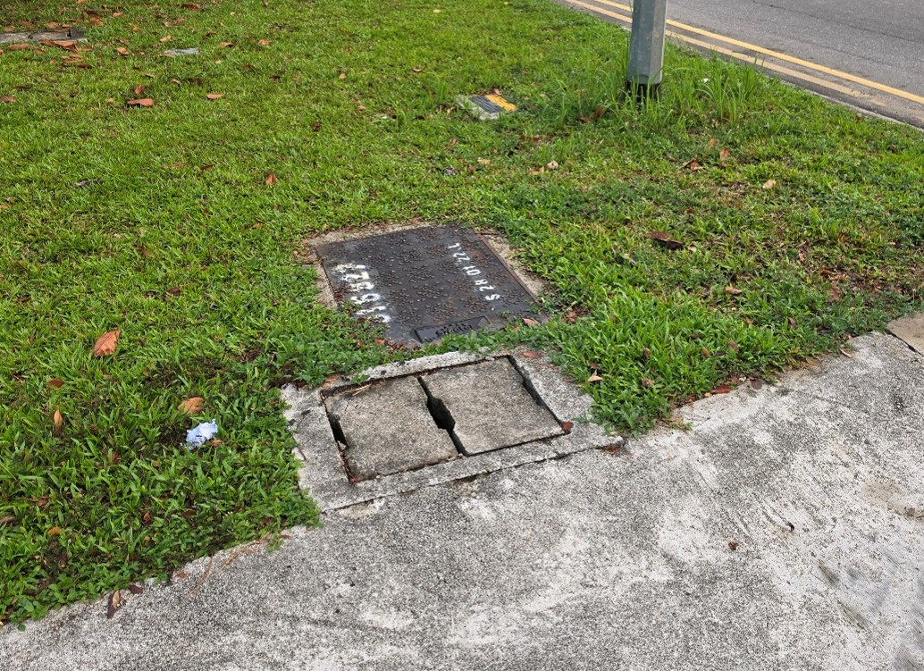
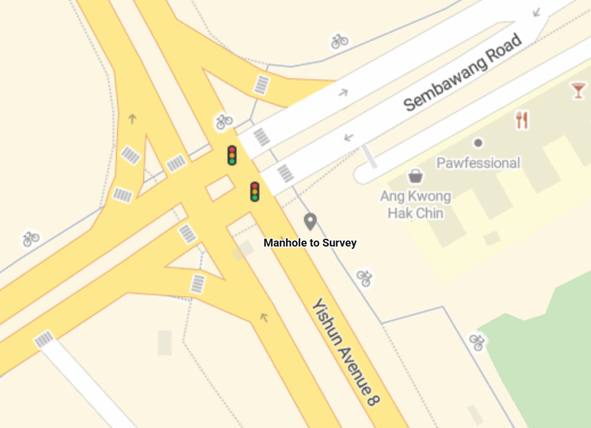 The challenge: survey the four corners of a manhole, randomly picked from the vicinity, and get the location as right as possible.
 The contestants:
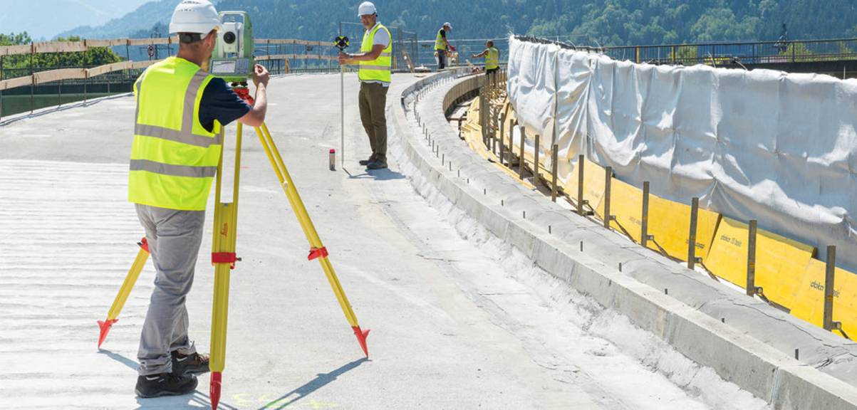 Closed loop traverse via total station, the gold standard for surveys, offering unparalleled accuracy and error handling through completing a geometric circuit on known control points. See a demonstration here. This method also serves as the benchmark for our topographic survey showdown.
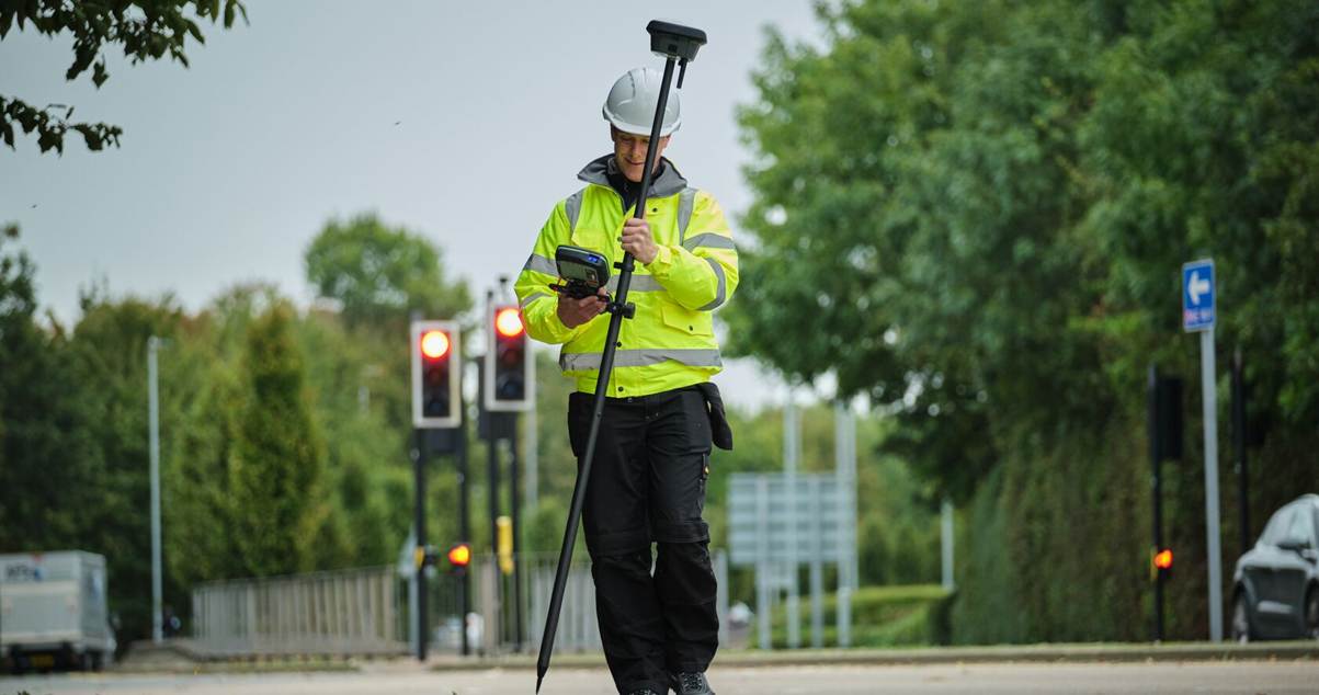 Global Navigation Satellite System (GNSS) Real-Time Kinematic (RTK), the big brother of the GPS chip in your smartphone, this antenna uses a network of satellites and base stations across the country to precisely calculate its current location. See a demonstration here.
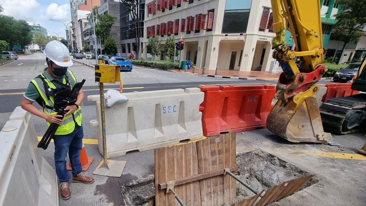 Photogrammetry kit, combining GNSS RTK with iPhone Pro’s light detection and ranging (lidar) package, a hyper localized scan of the manhole is taken and processed into a high-density cloud of geo-referenced points. See a demonstration here.
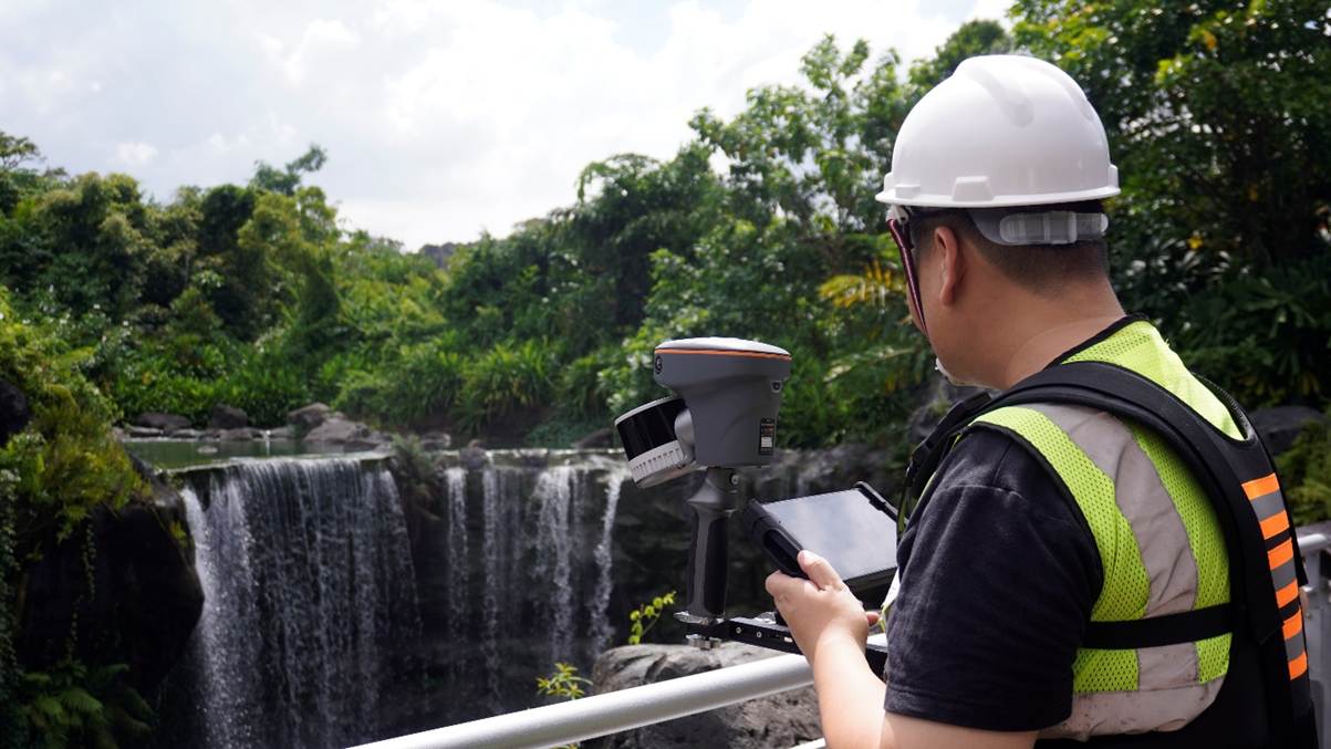 Handheld laser scanner, a custom-built head that is walked around the area to capture and process an ultra-high-density cloud of geo-referenced points. See a demonstration here.
The results:
Handheld laser scanner, a custom-built head that is walked around the area to capture and process an ultra-high-density cloud of geo-referenced points. See a demonstration here.
The results:
| |
2D Error |
3D Error |
Time Taken |
Distance Travelled |
| Total Station |
0 |
0 |
4 Days |
4900.00m |
| GNSS RTK |
12.38mm |
45.99mm |
30mins |
3.32m |
| Photogrammetry Kit |
16.84mm |
39.84mm |
10mins |
16.08m |
| Handheld Laser Scanner |
47.20mm |
63.06mm |
40mins |
329.05m |
There is a lot to unpack to decide a “winner”. Let us begin with definitions. 2D error is the Root Mean Square Error (RMSE) of each method when compared to the total station closed loop traverse survey, considering only latitude and longitude coordinates. 3D error applies RMSE while accounting for latitude, longitude, and altitude. Time taken is how long the survey team used to determine the coordinates of the manhole’s four corners with each method. Distance travelled is how far the survey team had to go to complete each method.
Perfect Accuracy – The Price is Time and Effort
The closed loop traverse survey with a total station is the go-to method for answering where something is exactly. Country borders, land parcel boundaries, building perimeters, and various other watersheds have been staked by surveyors the world over with these tools and methodology. Why should underground utilities and its accessories be handled any differently?
A network of control points needs to be established before any traverse survey can be done. For this proving ground, the coordinates of four horizontal control points and one vertical control point were obtained from authorities. Unfortunately, the closest useable points were all quite far, with the furthest being almost a kilometre away. This distance directly impacted how much time and effort the survey team had to put in to complete the gold standard measurements; 4 days of walking to cover 4.9km, repeating the monotonous cycle of total station setup, levelling, point recording, then total station teardown. The coordinates of 67 bridge points were gathered on top of the required 4 manhole corners to ensure data integrity via geometric closure.
.png) The Survey Team’s Journey – Total Station Closed Loop Traverse
Efficiency Through Satellites and Base Stations – Stay Still and Survey On
What if, instead, we used a GNSS RTK antenna? With over 30 satellites locked on to the survey team’s instrument, supplemented by triangulation from a local base station setup by the authorities, we bypass the need for control and bridge points, heading straight to coordinate measurements. Levelling the antenna over each corner of the manhole, the longer one can remain still for the instrument to collect data and aggregate it, the more accurate the gathered coordinates become. The survey team can rapidly deploy to the location, measure the required points, and be off to the next site within the hour.
The Survey Team’s Journey – Total Station Closed Loop Traverse
Efficiency Through Satellites and Base Stations – Stay Still and Survey On
What if, instead, we used a GNSS RTK antenna? With over 30 satellites locked on to the survey team’s instrument, supplemented by triangulation from a local base station setup by the authorities, we bypass the need for control and bridge points, heading straight to coordinate measurements. Levelling the antenna over each corner of the manhole, the longer one can remain still for the instrument to collect data and aggregate it, the more accurate the gathered coordinates become. The survey team can rapidly deploy to the location, measure the required points, and be off to the next site within the hour.
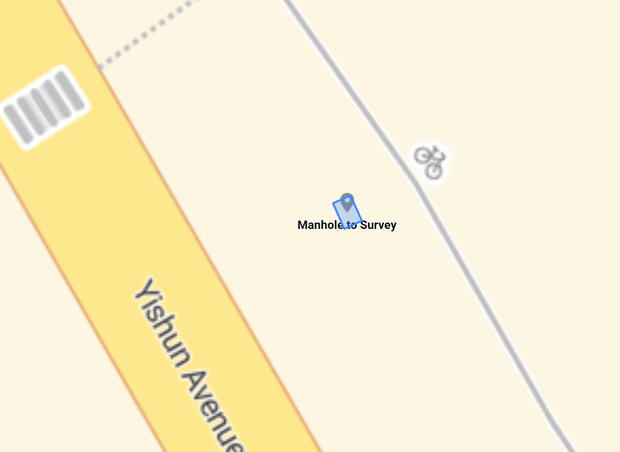 The Survey Team’s Journey – GNSS RTK
Introducing Data Comprehensiveness – A Scan Provides a Thousand Points
Picture this: the survey team has already moved on to their next assignment when a call comes in. The client needs more measurements taken of the manhole. By the way, could you also survey the other utility access points nearby? It’s a common scenario in our line of work when additional tasks are dropped in and ruin any semblance of a schedule. The surveyors could turn back, or they could have had the wherewithal to scan the area with a photogrammetry kit and made a digital twin of the location.
The Survey Team’s Journey – GNSS RTK
Introducing Data Comprehensiveness – A Scan Provides a Thousand Points
Picture this: the survey team has already moved on to their next assignment when a call comes in. The client needs more measurements taken of the manhole. By the way, could you also survey the other utility access points nearby? It’s a common scenario in our line of work when additional tasks are dropped in and ruin any semblance of a schedule. The surveyors could turn back, or they could have had the wherewithal to scan the area with a photogrammetry kit and made a digital twin of the location.
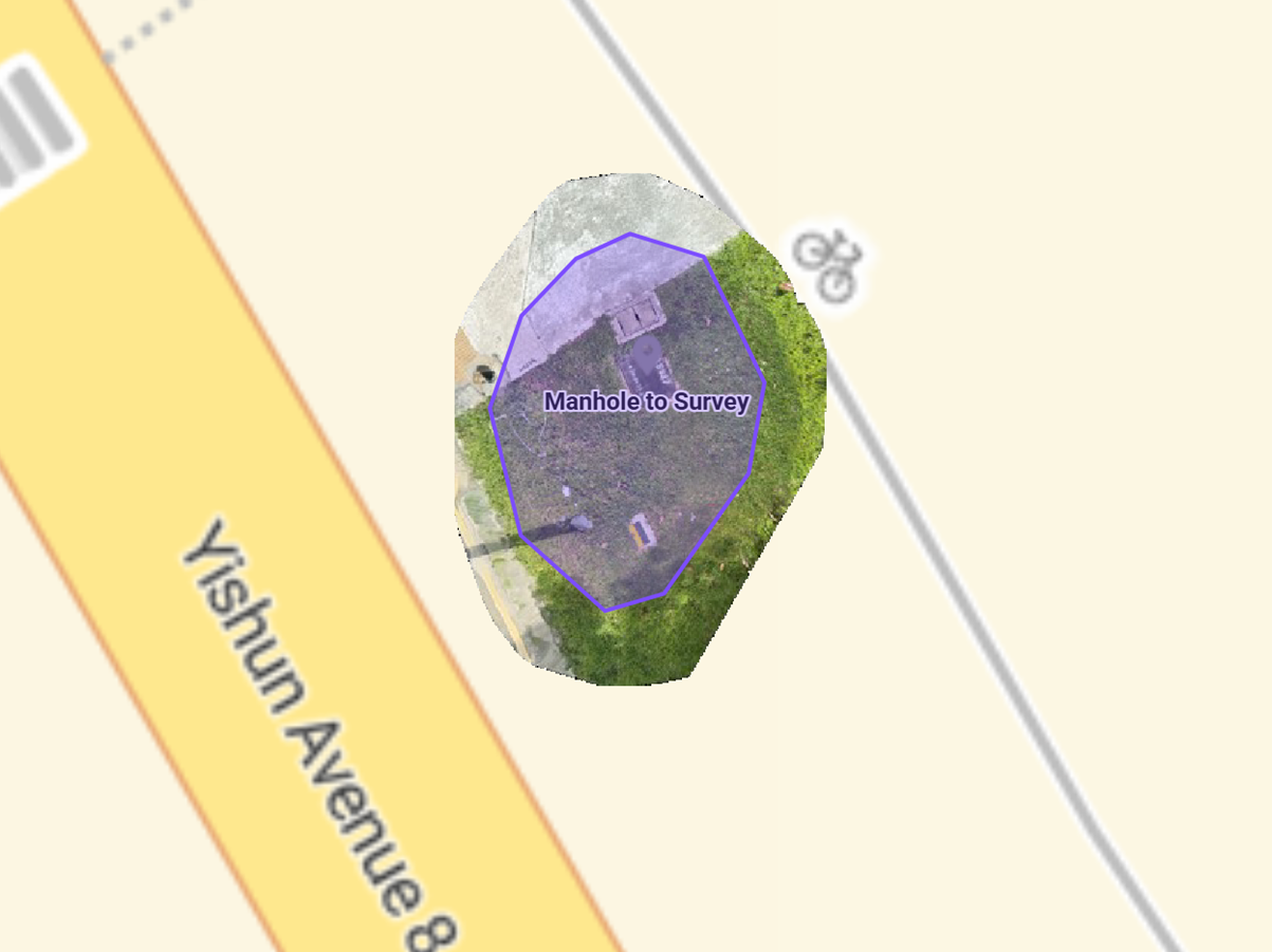 The Survey Team’s Journey, Digitally Twinned – Photogrammetry Kit
With the right configuration of software and equipment, the smartphone in your pocket can be turned into a powerful, geo-spatially accurate scanner, utilizing the internet of things to process a digital twin accessible via the web. Any number of measurements can be taken in it accurately and at your leisure, decoupling the need for field deployment to address ever-evolving client demands.
The Survey Team’s Journey, Digitally Twinned – Photogrammetry Kit
With the right configuration of software and equipment, the smartphone in your pocket can be turned into a powerful, geo-spatially accurate scanner, utilizing the internet of things to process a digital twin accessible via the web. Any number of measurements can be taken in it accurately and at your leisure, decoupling the need for field deployment to address ever-evolving client demands.
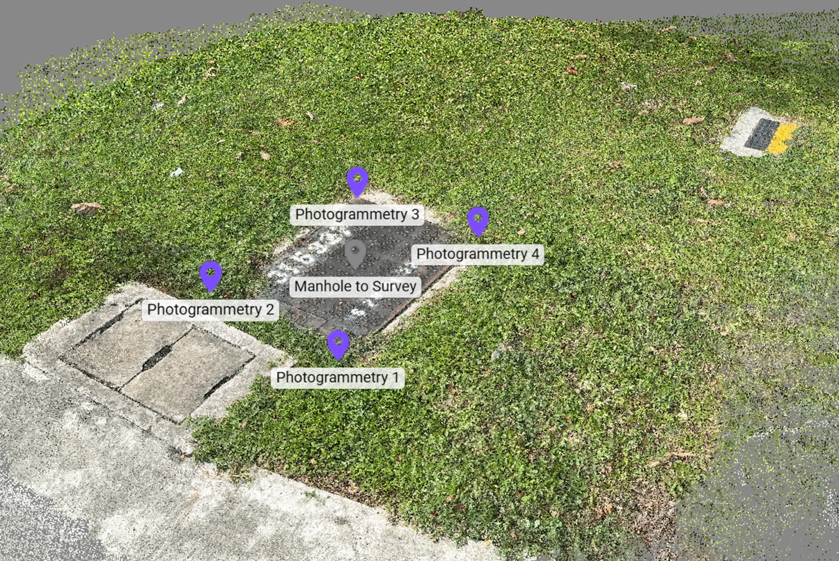 This is not a normal picture; it’s tens of thousands of points in a cloud
Scaling Up for Data Collection – We’re Going to Need a Bigger Scan
If we can scan the manhole and the area around it, why stop there? If clients and partners need measurements of the junction to carry on with their next steps (note: they always do), then our survey team provides with a handheld laser scanner.
This is not a normal picture; it’s tens of thousands of points in a cloud
Scaling Up for Data Collection – We’re Going to Need a Bigger Scan
If we can scan the manhole and the area around it, why stop there? If clients and partners need measurements of the junction to carry on with their next steps (note: they always do), then our survey team provides with a handheld laser scanner.
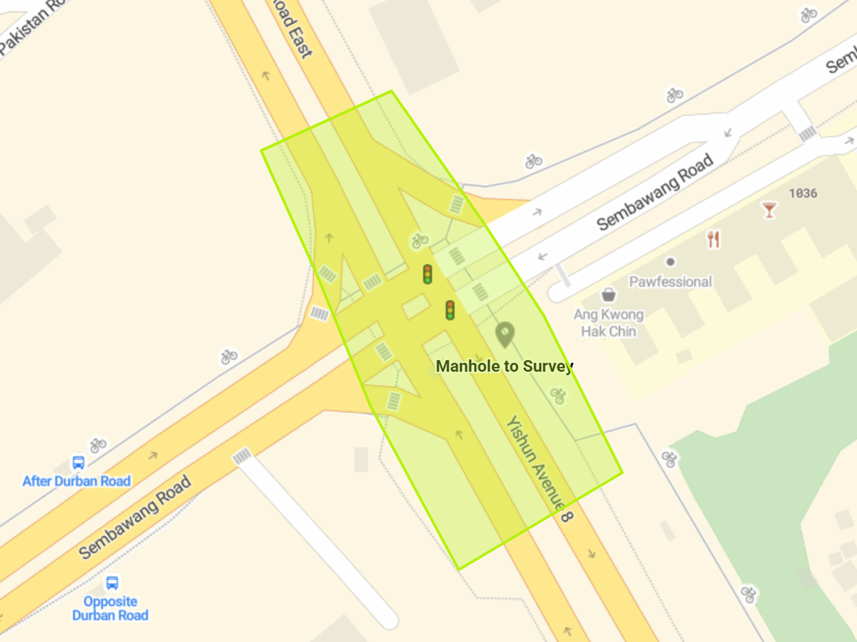 The Survey Team’s Journey – Handheld Laser Scanner
A brisk walk around the junction with the scanner in hand takes about 40 minutes, and the data still needs to be brought back to office for processing on a midrange computer for a few hours before the data can be reviewed. This is still largely preferable to the 4 days of total station traversing, and the quantity of relevant information is exponentially greater.
The Survey Team’s Journey – Handheld Laser Scanner
A brisk walk around the junction with the scanner in hand takes about 40 minutes, and the data still needs to be brought back to office for processing on a midrange computer for a few hours before the data can be reviewed. This is still largely preferable to the 4 days of total station traversing, and the quantity of relevant information is exponentially greater.
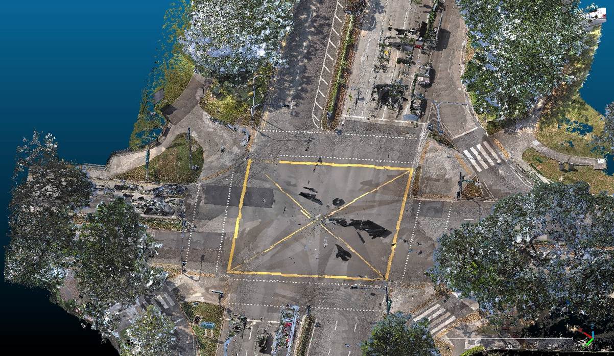 Millions of points connect to simulate reality – a digital twin, so to speak
Which Method is the Right One?
Following the standards set out by the Singapore Land Authority (SLA), the error in latitude and longitude measurements should not exceed 20mm. When adding the consideration of altitude, the error permitted is around 50mm.
Millions of points connect to simulate reality – a digital twin, so to speak
Which Method is the Right One?
Following the standards set out by the Singapore Land Authority (SLA), the error in latitude and longitude measurements should not exceed 20mm. When adding the consideration of altitude, the error permitted is around 50mm.
| |
2D Error
Threshold: 20mm |
3D Error
Threshold: 50mm |
| Total Station |
0 |
0 |
| GNSS RTK |
12.38mm |
45.99mm |
| Photogrammetry Kit |
16.84mm |
39.84mm |
| Handheld Laser Scanner |
47.20mm |
63.06mm |
Here’s an interactive look at each of the manhole corners measured by the four methods and their displacements.
While it looks like the handheld laser scanner method would not be able to pass quality assurance, it is much easier to re-survey the location via this method – just open the digital twin and re-pick the points. Same goes for the photogrammetry kit method. Regardless, the GNSS RTK and photogrammetry ways of answering where something is falls well within the acceptable limits of professional surveying here in Singapore.
 The surveyed points from each method, overlaid on the digital twin
The long and short of it is that your project requirements determine which method to deploy, and a mix of methods give you the best chance of ticking off all your checkboxes. Are you a facilities manager in need of data to support your building’s annual safety inspection? A total station closed loop traverse and handheld laser scan package will easily impress your superiors. You are a carpark operator deciding whether and how to paint more lots in the same area? Sampling key sections of your land parcel with photogrammetry and doing a quick sanity check of your legal bounds with GNSS RTK is probably for the best. Work with us to make the most of your project budget.
Want to see all the data we collected for this article? Check this out!
The surveyed points from each method, overlaid on the digital twin
The long and short of it is that your project requirements determine which method to deploy, and a mix of methods give you the best chance of ticking off all your checkboxes. Are you a facilities manager in need of data to support your building’s annual safety inspection? A total station closed loop traverse and handheld laser scan package will easily impress your superiors. You are a carpark operator deciding whether and how to paint more lots in the same area? Sampling key sections of your land parcel with photogrammetry and doing a quick sanity check of your legal bounds with GNSS RTK is probably for the best. Work with us to make the most of your project budget.
Want to see all the data we collected for this article? Check this out!Based in Singapore, GeoPulse Technologies combines traditional underground utility detection methods with advanced technologies like ground-penetrating radar and 3D scanning to map underground infrastructure quickly and accurately.
Posted by GEOPULSE TECHNOLOGIES PTE. LTD. on 29 May 26



 Singapore