FEATURE
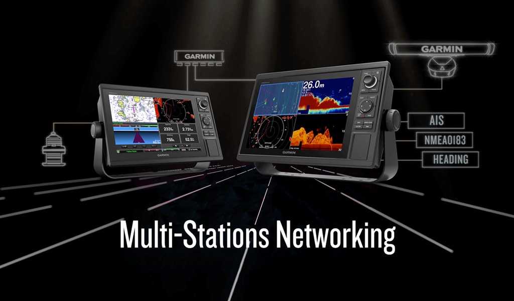
An advanced all-in-one solution with 12-inch AQUAMAP® keyed GPS Chartplotter/Fishfinder/Radar multifunction display (MFD) for professional market. Features a large, bright screen coupled with specific knob and short cut keys that makes the customers more convenience to use. Garmin Marine Network support allows you to share maps, user data, radar and IP cameras among multiple units. NMEA 2000® and NMEA 0183 supports network connectivity including autopilots, digital switching, weather, media, VHF, AIS, engine monitoring and other sensors. Includes full suite of built-in SailAssist features. With capability for Garmin CHIRP sonar, CHIRP ClearVü. It also has built-in support for Panoptix all-seeing sonar and premium Garmin sonar modules (transducers sold separately).
Garmin Marine Network support allows sharing of sonar, maps, user data, dome or open-array radar, IP cameras and Panoptix sonar among multiple units. Includes NMEA 2000® network connectivity and NMEA 0183 support for autopilots, digital switching, weather, media, VHF, AIS, engine monitoring and other sensors.
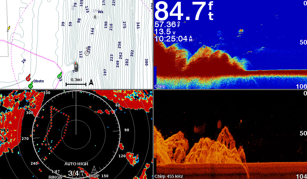
Right out of the box, you have access to some amazing sonar capabilities; all you have to add are transducers. Comes with built-in Garmin 500W 77/200kHz & 2kW 50/200kHz traditional sonar, 1 kW wide-band CHIRP sonar, 500W CHIRP ClearVü scanning sonar and also with capability to support optional the 3rd party 2kW traditional transducers. It even supports Panoptix all-seeing sonar, premium Garmin sonar modules and a wide range of transducers (sold separately).
Networked combos can share their internal sonar with any other device on the network. You can also choose what information is overlaid on the sonar screen; for example time of day or GPS speed.
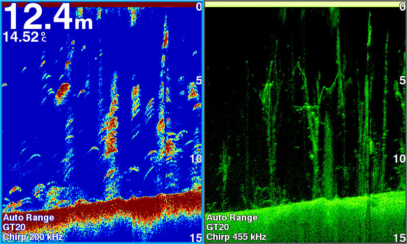
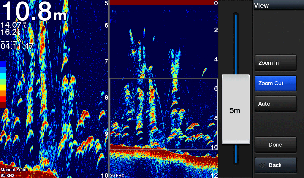
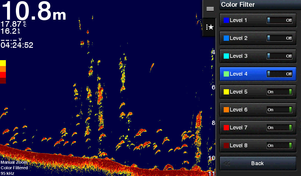
Shift Zoom feature lets you control your owned display portion to focus on detailed sonar data you need. Color Rejection feature lets you concentrate on simpler colors display on sonar page.
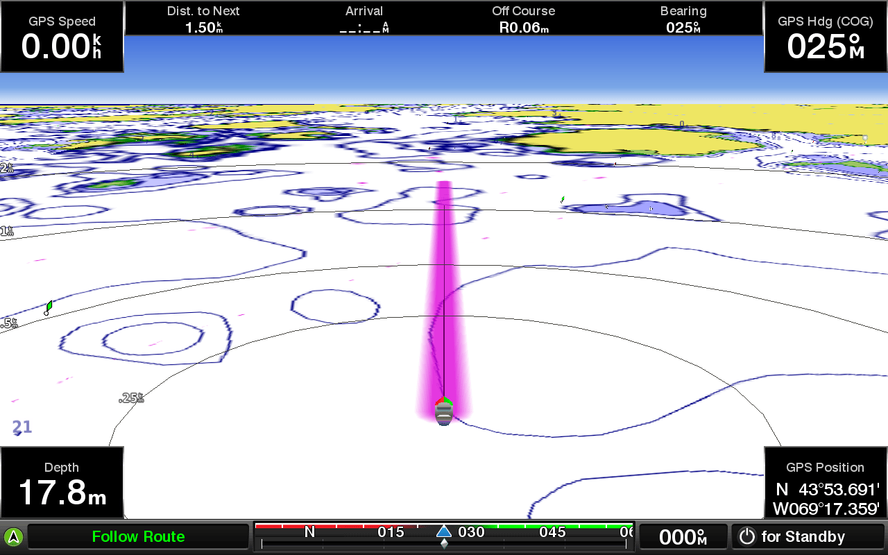
Fast, responsive built-in 10 Hz GPS, GLONASS and BEIDOU refreshes your position and heading 10 times each second to make your movement on the screen more fluid. It makes dropping up to 30,000 accurate waypoints — and finding your way back to them — quick and easy.
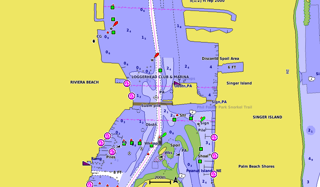
Two standard SD™ card slots provide expandable memory for accessory map purchases such as BlueChart g2 HD, BlueChart g2 Vision HD. The BlueChart g2 Vision HD provide exclusive Garmin Auto Guidance1, a technology that directs you to your hot spots. Based on your boat’s specifications, Auto Guidance instantly creates a visual path you can follow to avoid shallow water and other charted obstructions.
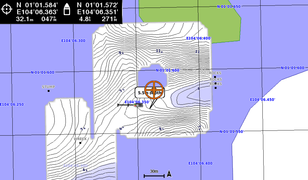
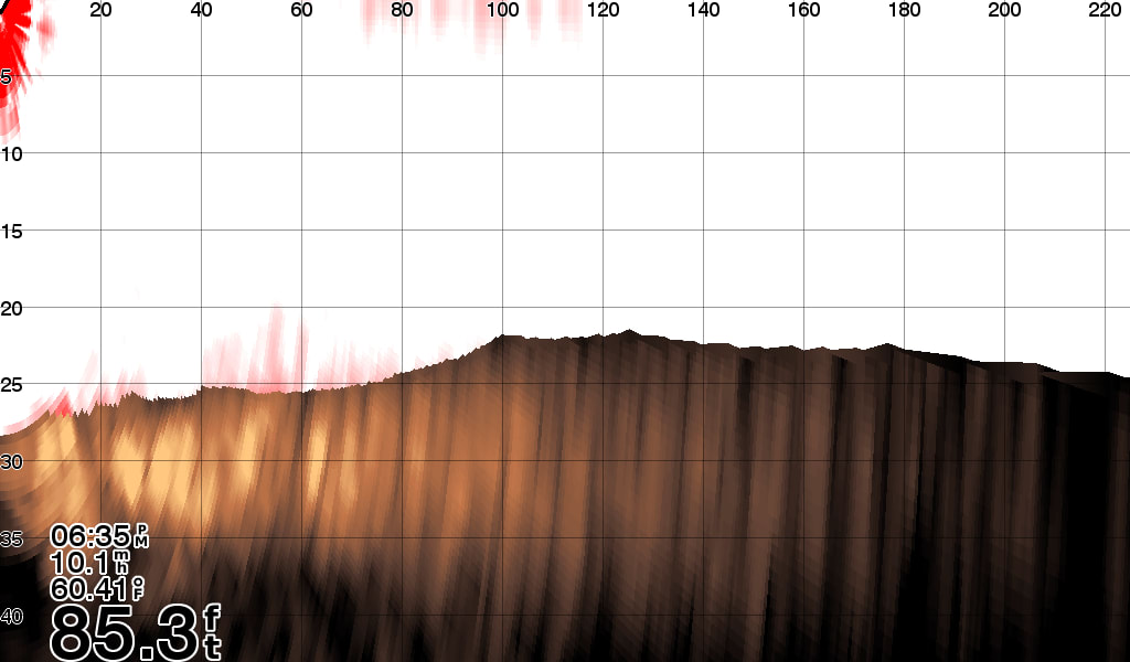
Quickdraw Contours is a free, easy-to-use software feature already installed on your AQUAMAP. It instantly creates your own personalized HD fishing maps on screen with 1-foot contours. Tailor the maps as needed; you own them. Keep the data for yourself, or share it with Garmin or your friends through Quickdraw Community on Garmin Connect™. No special surveying expertise is required. You just fish while Quickdraw Contours creates maps. There’s no waiting around or sending your files away like other mapping software requires — your results appear instantly.
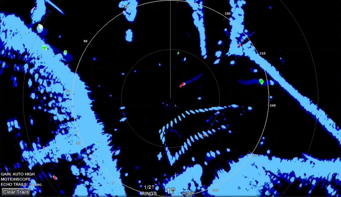
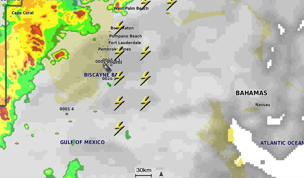
MotionScope™ technology uses the Doppler effect to detect and highlight moving targets to help avoid collisions, find flocks of birds and track weather formations. The Doppler effect is the frequency shift in the radar echo due to the relative motion of the target. This allows for instant detection of any targets moving toward or away from the radar. MotionScope highlights the moving targets on the radar display so you can navigate around other boats or severe weather — or toward fishing spots where birds are feeding at the surface.
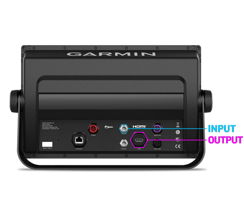
Share display from other device and you can output video to bigger screen and even out of the bridge
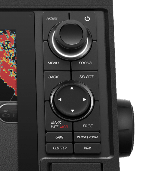
With 12 inch large, bright displays that feature keypad interface with shortcut GAIN/CLUTTER/RANGE/VRM keys and multifunction knob.
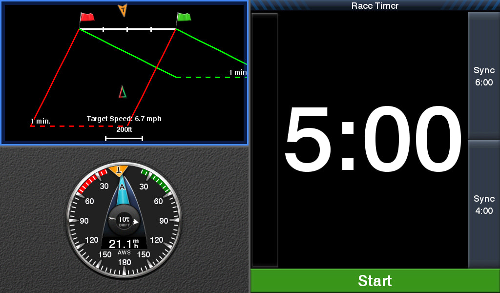
To help you gain a wind-maximizing competitive edge, your multifunction display (MFD) features a pre-race guidance page that shows your virtual starting line along with data fields showing laylines, time to burn before the start and a race timer that can be synchronized across all your networked Garmin GPS products. In addition, other supported sailing features include an enhanced wind rose, heading and course-over-ground lines, set and drift, true and apparent wind data and more.
GPX Waypoints TransferIf you have waypoints, tracks or frequently used routes stored on another manufacturer’s GPS product — or on a Garmin handheld device — it’s easy to transfer those items to your new Garmin multifunction display (MFD) via industry-standard GPX software formatting.
SPECIFICATION
General |
|
| Water ratin g | IPX7 |
Physical & Performance |
|
| Physical dimensions | 14.1" x 8.9" x 2.7" (35.8 x 22.6 x 6.9 cm) |
| Display size, WxH | 10.3" x 6.4" (26.2 x 16.3 cm) |
| Display resolution, WxH | 1280 x 800 pixels |
| Display type | WSVGA display |
| Weight | 5.2 lbs. (2.34 kg) |
| Antenna | External BNC or external over NMEA 2000 |
| NMEA 2000® compatible | √ |
| NMEA 0183 compatible | √ |
| Power consumption | Max power usage at 12 Vdc: 43.2 W Typical current draw at 12 Vdc: 2.2 A Max current draw at 12 Vdc: 3.6 A |
| Mounting options | Bail or flush |
| Garmin Marine Network™ | √ |
Maps & Memory |
|
| Preloaded maps | Worldwide Basemap |
| Accepts data cards | 2 SD™ cards |
| Waypoints | 30,000 |
| Routes | 200 |
| Track log | 50,000 points; 50 saved tracks |
Chartplotter Features |
|
| Garmin Radar compatible | √ |
| Garmin Sonar compatible | √ |
| Supports AIS (tracks target ships position) | √ |
| Supports DSC (displays position data from DSC-capable VHF radio) | √ |
| Tide tables | √ |
| GSD™ Black Box sonar support | √ |
| GCV™ Black Box sonar support | √ |
| GRID™ (Garmin Remote Input Device) compatible | √ |
Sonar Features & Specifications |
|
| Dual-frequency (50/200 kHz) sonar capable | √ |
| Dual-beam (77/200 kHz) sonar capable | √ |
| Frequencies supported | Traditional: 50/200, 77/200 kHz Single Channel CHIRP: 40 to 240 kHz Garmin ClearVü CHIRP: 260/455/800 kHz (dependent on transducer) |
| Transmit power (RMS) |
Traditional 50/200 kHz sonar: 2 kW 77/200 kHz sonar: Max 500W CHIRP high/mid/low bands : Max 1kW Garmin ClearVü CHIRP: Max 500 W (dependent on transducer) |
| CHIRP sonar technology | √ |
| ClearVü | √ |
| Maximum depth | 5,000 ft at 2kW (depth capacity is dependent on water bottom type and other water conditions) |
| Bottom lock (shows return from the bottom up) | √ |
| Water temperature log and graph | √ |
| Sonar recording | √ |
| Sonar history rewind | √ |
Connections |
|
| Transducer pin numbers | 8 |
| NMEA 0183 compatible ports | 2 |
| Video input/output | √ |
 Malaysia


